|
||
|
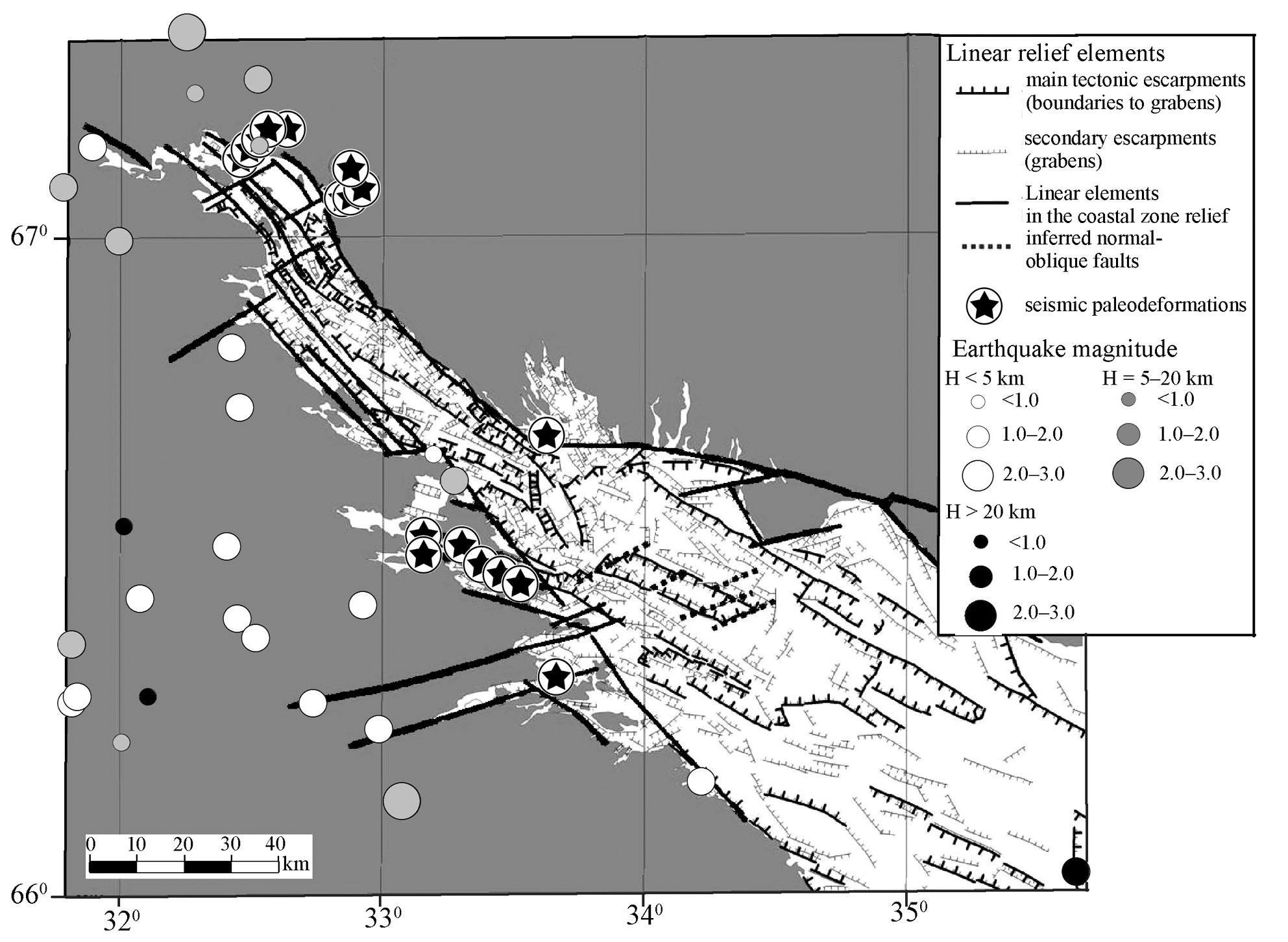
A morphostructural map of the seafloor and coasts of the Kandalaksha Gulf made by S.V. Shvarev using a digital elevationmodel; seismicity is shown for comparison. The legend on the right gives a classification of the earthquakes over depth of focus (H) and magnitude (circle size) |